Best Route to Mantralayam During Monsoon – 7 Safe and Proven Routes You Need to Know
Traveling to Mantralayam during monsoon is a completely different experience compared to summer or winter. The Tungabhadra River swells to its full glory, the dry Rayalaseema landscape turns lush green, and the temple town feels refreshingly cool. But here’s the catch — monsoon also brings flooded roads, waterlogged stretches, bus cancellations, and unpredictable detours.
So what is the best route to Mantralayam during monsoon? That depends on where you’re starting from, what vehicle you’re using, and how heavy the rains have been that week. I’ve personally traveled to Mantralayam during the rainy season multiple times, and trust me — picking the right route makes the difference between a spiritual, peaceful trip and a stressful ordeal.
The monsoon season in the Mantralayam region runs from June to September, with the heaviest rainfall typically between July and August — exactly when the famous Aradhana Mahotsavam takes place. Lakhs of pilgrims travel to Mantralayam during monsoon for this grand festival, and many face route-related challenges because they didn’t plan ahead.
Let me walk you through every route option, real road conditions, flood-prone zones to avoid, and the exact best route to Mantralayam during monsoon based on your starting city. This is the guide I wish I had before my first rainy-season trip.
Table of Contents
- Why Choosing the Best Route to Mantralayam During Monsoon Matters
- Best Route to Mantralayam During Monsoon from Hyderabad
- Best Route to Mantralayam During Monsoon from Bangalore
- Best Route to Mantralayam During Monsoon from Kurnool
- Best Route to Mantralayam During Monsoon from Raichur
- Best Route to Mantralayam During Monsoon by Train
- Monsoon Road Conditions – Flood-Prone Zones and Safe Stretches
- Tungabhadra River Flood Alert and How It Affects Travel
- Mantralayam Monsoon Travel Checklist – What to Pack
- Best Time to Start Your Journey During Monsoon
- Where to Stay in Mantralayam During Monsoon Season
- Monsoon Route Comparison Table – All Starting Cities
- Common Monsoon Travel Mistakes to Avoid
- FAQ – Best Route to Mantralayam During Monsoon
Why Choosing the Best Route to Mantralayam During Monsoon Matters
You might wonder — roads are roads, why does the season matter so much? Let me explain why finding the best route to Mantralayam during monsoon is genuinely critical and not just a nice-to-have.
The Tungabhadra Factor
Mantralayam sits right on the banks of the Tungabhadra River. During monsoon, this river receives water from heavy rains across Karnataka and Andhra Pradesh, plus dam releases from Tungabhadra Dam near Hospet. When the river level rises dramatically — which happens multiple times every monsoon — the low-lying approach roads near Mantralayam can get submerged.
In severe flood situations, the bridge connecting Mantralayam to nearby towns has been closed temporarily. This happened in 2019 and again in 2022 when water levels breached warning marks. Choosing the best route to Mantralayam during monsoon means knowing which roads are elevated, which bridges are flood-resistant, and which alternate paths exist.
Road Damage and Potholes
The Rayalaseema and North Karnataka region has several roads that deteriorate significantly during monsoon. Potholes appear overnight, gravel stretches turn into mud trails, and some village roads become practically impassable. The best route to Mantralayam during monsoon avoids these trouble spots entirely.
Bus and Train Disruptions
APSRTC and KSRTC buses occasionally cancel services on flood-affected routes. Passenger trains to Mantralayam Road station sometimes face delays of 2-4 hours during heavy rain. Knowing the best route to Mantralayam during monsoon helps you have backup plans ready.
Quick Tip: Before starting your trip during monsoon, always check the Tungabhadra Dam water release status. The Tungabhadra Dam authorities issue alerts that directly affect road conditions near Mantralayam. A simple Google search for “Tungabhadra dam water level today” gives you real-time data.
Best Route to Mantralayam During Monsoon from Hyderabad
Hyderabad is the most common starting point for Mantralayam pilgrims, and finding the best route to Mantralayam during monsoon from Hyderabad requires understanding which highway stretches hold up well in rain.
Route A – Via NH44 through Kurnool (Recommended for Monsoon)
This is the best route to Mantralayam during monsoon from Hyderabad because NH44 is a well-maintained 4-lane national highway for most of the journey. Here’s the breakdown:
- Hyderabad → Kurnool: 213 km via NH44 (3.5 hours)
- Kurnool → Mantralayam: 78 km via Kosigi (1.5 hours)
- Total distance: ~291 km
- Total monsoon travel time: 5 to 6 hours
Why this is the best route to Mantralayam during monsoon from Hyderabad:
- NH44 has excellent drainage. Water doesn’t pool on the highway even during heavy downpours
- The 4-lane stretch from Hyderabad to Kurnool is elevated above surrounding farmland, reducing flood risk
- Multiple fuel stations, restaurants, and emergency services along the entire route
- APSRTC buses run on this route even during moderate monsoon conditions
- The Kurnool-Kosigi stretch on NH44 is also 4-lane and handles rain well
Route B – Via Mahabubnagar and Raichur
- Hyderabad → Raichur: 280 km (5 hours)
- Raichur → Mantralayam: 55 km (1.5 hours)
- Total distance: ~335 km
- Total monsoon travel time: 6.5 to 8 hours
Monsoon verdict: NOT the best route to Mantralayam during monsoon. The road between Mahabubnagar and Raichur passes through low-lying agricultural zones that flood regularly. Several river crossings on this route become dangerous during heavy rains. I would avoid this route entirely between July and September.
Route C – Via Nagpur Highway and Mantralayam Road Station
Some travelers take NH44 northward and then cut through toward Mantralayam Road railway area. This route is longer and adds unnecessary complexity during monsoon. Not recommended.
My recommendation for Hyderabad travelers: Route A via Kurnool is clearly the best route to Mantralayam during monsoon. It stays on national highways for 90% of the journey, offers reliable road surfaces, and has the highest frequency of bus services even in rainy weather.
Pro Tip: If you’re driving from Hyderabad and it starts raining heavily near Kurnool, there’s a comfortable rest stop at Kurnool town itself. Several hotels near Kurnool bus stand offer rooms starting at ₹800-1,200. Wait out the worst rain, get some rest, and complete the remaining 78 km to Mantralayam when conditions improve. That patience can save your trip. Check our hotels near Mantralayam for overnight options.
Best Route to Mantralayam During Monsoon from Bangalore
Bangalore is the second-largest source of pilgrims to Mantralayam, and the best route to Mantralayam during monsoon from Bangalore differs from the dry-season route most people take.
Route A – Via NH44 and Anantapur-Kurnool (Safest Monsoon Route)
- Bangalore → Anantapur: 265 km via NH44 (4 hours)
- Anantapur → Kurnool: 80 km (1.5 hours)
- Kurnool → Mantralayam: 78 km via Kosigi (1.5 hours)
- Total distance: ~423 km
- Total monsoon travel time: 7 to 8.5 hours
This is the best route to Mantralayam during monsoon from Bangalore because it maximizes your time on NH44 — India’s best-maintained highway corridor. The road surface handles monsoon rains exceptionally well, and you avoid the problematic rural stretches that plague other routes during rainy season.
Route B – Via Raichur (Shorter but Riskier)
- Bangalore → Raichur: 370 km via NH50 (6.5 hours)
- Raichur → Mantralayam: 55 km (1.5 hours)
- Total distance: ~425 km
- Total monsoon travel time: 8 to 10 hours
Monsoon verdict: The Bangalore-Raichur road via NH50 passes through Sindhanur and several river crossings in the Krishna-Tungabhadra basin. During heavy monsoon, this route becomes unreliable. Waterlogging near Sindhanur and bridge closures near Raichur have stranded travelers in past years. This is NOT the best route to Mantralayam during monsoon from Bangalore.
Route C – Via Hospet and Gangavathi
- Bangalore → Hospet: 340 km (6 hours)
- Hospet → Gangavathi → Raichur → Mantralayam: 150 km (3.5 hours)
- Total distance: ~490 km
- Total monsoon travel time: 9.5 to 11 hours
This route is very long and only makes sense if you plan to visit Hampi along the way. During monsoon, the Gangavathi-Raichur road can be tricky. Not recommended as the best route to Mantralayam during monsoon unless Hampi is part of your itinerary.
My recommendation for Bangalore travelers: Route A through Anantapur and Kurnool is the best route to Mantralayam during monsoon from Bangalore. Yes, it’s slightly longer in distance, but the road quality and safety make it worth every extra kilometer.
Quick Tip: KSRTC runs overnight sleeper buses from Bangalore to Kurnool. You can take one of these, arrive in Kurnool early morning, and then catch an APSRTC bus to Mantralayam. This splits the journey nicely and you avoid driving in monsoon darkness — which is genuinely dangerous on these roads.
Best Route to Mantralayam During Monsoon from Kurnool
Kurnool is the closest major city to Mantralayam, and finding the best route to Mantralayam during monsoon from Kurnool is straightforward — but there are a few things to watch out for.
Primary Route – Via NH44 and Kosigi
- Kurnool → Kosigi: 45 km on NH44 (45 minutes)
- Kosigi → Mantralayam: 32 km on state highway (40 minutes)
- Total distance: ~78 km
- Total monsoon travel time: 1.5 to 2 hours
This remains the best route to Mantralayam during monsoon from Kurnool. The NH44 stretch from Kurnool to Kosigi is a 4-lane highway with proper drainage, so it handles monsoon rains without issues. The only stretch that needs caution is the last 32 km from Kosigi to Mantralayam.
Monsoon Concerns on the Kosigi-Mantralayam Stretch
The road from Kosigi to Mantralayam is a 2-lane state highway that passes through low-lying agricultural land. During heavy rains, you may encounter:
- Waterlogging near villages — especially Peddakadubur area
- Reduced visibility in heavy downpours
- Slippery patches where mud from farm roads washes onto the main road
- The Mantralayam approach road near the Tungabhadra can flood if river levels are very high
Despite these concerns, this is still the best route to Mantralayam during monsoon from Kurnool because there’s simply no better alternative. The key is timing — drive during daylight hours and avoid traveling immediately after very heavy rainfall.
Alternate Route – Via Nandyal Road and Pattikonda
Some locals suggest an alternate route through Pattikonda, but during monsoon, this route is actually worse. It passes through more rural roads with poorer drainage, making it a bad choice for monsoon travel. Stick to the NH44-Kosigi route as the best route to Mantralayam during monsoon from Kurnool.
Pro Tip: If you’re in Kurnool and heavy rain has been falling for 3-4 hours straight, call the Mantralayam Mutt office or check local WhatsApp groups for road updates before starting. Local taxi drivers in Kurnool are also excellent sources for real-time road information. A 5-minute phone call can save you hours of trouble. For more details on this route, check our guide on how to reach Mantralayam from Kurnool.
Best Route to Mantralayam During Monsoon from Raichur
Raichur is just 55 km from Mantralayam, making it one of the closest cities. But don’t let the short distance fool you — finding the best route to Mantralayam during monsoon from Raichur needs careful attention because the terrain between these two towns is dominated by the Tungabhadra River basin.
Direct Route – Raichur to Mantralayam
- Distance: 55 km
- Normal travel time: 1 hour 15 minutes
- Monsoon travel time: 1.5 to 2.5 hours (depending on conditions)
The direct road from Raichur to Mantralayam follows the state highway along the Tungabhadra basin. During monsoon, this is the best route to Mantralayam during monsoon from Raichur — primarily because there’s no practical alternative for such a short distance.
Monsoon Challenges on this Route
The Raichur-Mantralayam road has a few trouble spots during monsoon:
- Km 15-25 from Raichur: Low-lying area prone to waterlogging after sustained heavy rains
- Near Kavital village: A small stream crossing that can flood during heavy downpours
- Last 5 km approach to Mantralayam: Close to the Tungabhadra River, this stretch floods when dam releases are high. In extreme cases, water has covered the road surface by 1-2 feet
When to Avoid This Route
If the Tungabhadra Dam releases more than 1 lakh cusecs of water, the approach roads to Mantralayam from the Raichur side can become dangerous. Local authorities set up barricades when this happens. Don’t try to drive through — water on the road is deeper than it looks.
My recommendation: The direct road is still the best route to Mantralayam during monsoon from Raichur, but have a backup plan. If road conditions are bad, stay in Raichur for a few hours and let the water recede. Raichur has decent hotels near the bus stand starting at ₹600-1,000 per night.
Quick Tip: If you’re approaching Mantralayam from Raichur during monsoon and find the last 5 km flooded, don’t panic. Local jeep services operate during moderate flooding, ferrying pilgrims to the temple for ₹100-200 per person. These jeep drivers know exactly which parts of the road are safe. Ask at the nearest police checkpoint.
Best Route to Mantralayam During Monsoon by Train
During monsoon, roads can become unpredictable. That’s why many experienced pilgrims consider the train as the best route to Mantralayam during monsoon — at least for part of the journey. Trains are less affected by rain than road transport (unless there’s severe flooding on tracks).
Mantralayam Road Railway Station (MTML)
The nearest railway station to Mantralayam temple is Mantralayam Road (MTML), located about 20 km from the town. Several passenger and a few express trains stop here.
Best Train Routes During Monsoon
From Hyderabad/Secunderabad:
- Take any express train toward Guntakal or Raichur
- Get off at Mantralayam Road (MTML) station
- Journey time: 5-7 hours depending on the train
- Fare: ₹180-500 (Sleeper to 3AC)
From Bangalore:
- Take a train to Guntakal Junction
- Change to a passenger train toward Raichur that stops at MTML
- Total journey: 8-12 hours with connection wait
- Fare: ₹300-800
From Kurnool:
- Passenger trains from Kurnool Town (KRNT) to MTML
- Journey time: 1.5-2 hours
- Fare: ₹30-60
Monsoon Train Advantages
Why the train can be the best route to Mantralayam during monsoon:
- Rain doesn’t stop trains (unless there’s track flooding, which is rare on this route)
- No risk of road accidents due to slippery surfaces or reduced visibility
- Comfortable overnight options from Hyderabad — you sleep through the journey and arrive fresh
- No need to worry about fuel, road conditions, or navigation
Getting from MTML Station to Mantralayam Town
The 20 km gap between the station and the temple is the one tricky part. During monsoon:
- Auto rickshaws charge ₹250-400 (higher than dry season rates of ₹200-300)
- Shared jeeps run during peak pilgrimage times at ₹80-150 per person
- Local buses are available but less frequent during heavy rains
Book your train tickets early on IRCTC, especially during the Aradhana festival period in July-August when trains fill up weeks in advance.
Pro Tip: If you’re choosing the train as the best route to Mantralayam during monsoon, book a ticket on the Hyderabad-Raichur Express or Secunderabad-Guntakal Express that arrives at MTML station in the morning (7-9 AM). This gives you daylight hours to travel the 20 km from the station to Mantralayam town, when road conditions are most visible and auto services are readily available.
Monsoon Road Conditions – Flood-Prone Zones and Safe Stretches
To help you identify the best route to Mantralayam during monsoon regardless of your starting point, here’s a detailed breakdown of road conditions and known flood-prone zones in the Mantralayam region.
Safe Roads (Green Zones)
These stretches hold up well even during heavy monsoon rains:
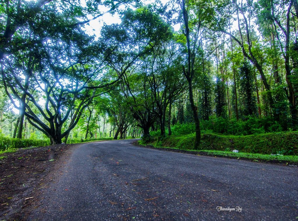
- NH44 (Hyderabad to Kurnool) — 4-lane highway with excellent drainage. Safe throughout monsoon season. This is why any route using NH44 is typically the best route to Mantralayam during monsoon.
- NH44 (Kurnool to Kosigi) — Same 4-lane quality continues. Very safe.
- Anantapur to Kurnool — NH44 stretch, well-maintained even in peak monsoon.
- Railway route (any section) — Tracks are elevated and rarely flood in this region.
Moderate Risk Roads (Yellow Zones)
These stretches are usually fine but can get challenging during heavy continuous rain:
- Kosigi to Mantralayam (32 km) — 2-lane state highway. Gets waterlogged in patches after 4-5 hours of continuous rain. Passable with caution in a car or SUV.
- Raichur to Mantralayam (55 km) — Low-lying areas near Tungabhadra basin. Moderate flooding risk during heavy rains.
- Gangavathi to Raichur — Agricultural belt with some drainage issues. Usually manageable.
High Risk Roads (Red Zones)
Avoid these stretches during heavy monsoon if possible:
- Last 5 km approach to Mantralayam (especially from the Raichur side) — Directly along Tungabhadra River. Floods when dam releases are high. Has been closed multiple times in past monsoons.
- Mahabubnagar to Raichur via interior roads — Multiple river crossings, poor drainage, highly flood-prone.
- Sindhanur to Raichur — Krishna-Tungabhadra basin. Regular flooding during July-August.
- Rural shortcuts through villages — Never take uncharted shortcuts during monsoon. What looks like a path can be a flooded field.
Road Condition Quick Reference Table
| Road Stretch | Monsoon Safety | Road Type | Flood Risk | Recommended? |
|---|---|---|---|---|
| NH44 (Hyd-Kurnool) | ✅ Safe | 4-lane highway | Very Low | Yes — best route to Mantralayam during monsoon backbone |
| NH44 (Kurnool-Kosigi) | ✅ Safe | 4-lane highway | Very Low | Yes |
| Kosigi-Mantralayam | ⚠️ Moderate | 2-lane state | Medium | Yes, with caution |
| Raichur-Mantralayam | ⚠️ Moderate | 2-lane state | Medium-High | Yes, check conditions first |
| Mahabubnagar-Raichur | ❌ Risky | Mix of roads | High | Avoid during heavy monsoon |
| Sindhanur-Raichur | ❌ Risky | State highway | High | Avoid July-August |
| Mantralayam approach (last 5 km) | ❌ Variable | Local road | Very High (river dependent) | Check dam release levels |
This table should help you plan the best route to Mantralayam during monsoon by avoiding high-risk stretches and sticking to safe highways.
Tungabhadra River Flood Alert and How It Affects Travel
Understanding the Tungabhadra River’s behavior during monsoon is essential for anyone planning the best route to Mantralayam during monsoon. The river directly affects access to the temple town.
How Floods Happen Near Mantralayam
Mantralayam is located on the right bank of the Tungabhadra River. The river’s water level at Mantralayam depends on:
- Rainfall in the upper catchment (Western Ghats of Karnataka)
- Tungabhadra Dam releases at Hospet (about 130 km upstream)
- Local rainfall in the Mantralayam area
When the Tungabhadra Dam crest gates are opened for heavy releases (typically above 50,000-1,00,000 cusecs), the water reaches Mantralayam in approximately 12-18 hours. This causes the river to swell, and the low-lying areas around Mantralayam — including some approach roads — can flood.
Past Flood Incidents
- 2019: Severe flooding. Tungabhadra releases crossed 2 lakh cusecs. Mantralayam was partially cut off for 2 days. Army rescue operations were conducted.
- 2020: Moderate flooding. Roads waterlogged but passable with difficulty.
- 2022: Bridge approach roads flooded for 36 hours. Pilgrims were stranded in Mantralayam.
- 2024: Dam releases caused temporary road closures. Situation normalized within 24 hours.
How to Monitor Flood Risk
Before you travel, use these resources to check conditions and plan the best route to Mantralayam during monsoon:
- Tungabhadra Dam water level: Google “Tungabhadra dam water level today” for real-time data
- AP Disaster Management Authority: Issues alerts for flood-prone areas
- Mantralayam Mutt social media pages: Often post road condition updates during monsoon
- Local news channels: Telugu and Kannada news channels cover Mantralayam flooding extensively during monsoon
Pro Tip: If the Tungabhadra Dam release exceeds 1 lakh cusecs, postpone your trip by 24-48 hours if possible. The water recedes quickly once releases reduce. This single precaution can be the difference between a safe trip and a dangerous one. Always prioritize safety when identifying the best route to Mantralayam during monsoon.
Mantralayam Monsoon Travel Checklist – What to Pack
Choosing the best route to Mantralayam during monsoon is only half the battle. You also need to pack smart for rainy-season travel in this region. Here’s my tested checklist:
Essential Items
- Raincoat or waterproof poncho (more practical than an umbrella at the temple)
- Waterproof bags/zip-lock bags for phone, wallet, and documents
- Extra set of dry clothes in a waterproof bag
- Sturdy waterproof footwear — NOT slippers or sandals. Temple floors get extremely slippery when wet
- Mosquito repellent — mosquitoes multiply rapidly during monsoon in this river-basin region
- Power bank — electricity outages are common during monsoon storms
- Flashlight or phone torch — useful if traveling during early morning or evening hours
- Basic medicines — pain relief, anti-diarrheal, ORS packets. Waterborne illness risk increases during monsoon
For Car/Bike Travelers
- Full tank of fuel before entering the Mantralayam region
- Emergency toolkit with spare tire in good condition
- 2-3 liters of water per person
- Offline Google Maps downloaded for the entire route (mobile networks get patchy during storms)
- Car charger for phone
- Old newspapers/towels in the car for wet shoes and clothes
Documents to Carry (Physical Copies)
During monsoon, your phone might die or get wet. Carry physical copies of:
- Driving license and vehicle RC
- Hotel booking confirmation
- Train/bus tickets if applicable
- Emergency contact numbers written on paper
Quick Tip: Keep all your electronics in a large zip-lock bag inside your main bag. One heavy downpour while walking from the parking lot to the temple can soak everything in seconds. I learned this the hard way during a July visit to Mantralayam.
Best Time to Start Your Journey During Monsoon
Timing your departure correctly is just as important as picking the best route to Mantralayam during monsoon. The rain patterns in this region follow a somewhat predictable daily cycle during peak monsoon.
Typical Monsoon Rain Pattern
- Early morning (5-8 AM): Usually dry or light drizzle. Best time to drive
- Mid-morning to afternoon (10 AM – 3 PM): Clouds build up. Scattered showers possible
- Late afternoon to evening (4-8 PM): Heaviest rainfall typically occurs during this window
- Night (9 PM – 4 AM): Rain usually subsides. But driving in the dark on wet roads is risky
Recommended Departure Times
From Hyderabad (291 km): Leave by 4 AM. You’ll cover the safe NH44 stretch in morning light and reach Mantralayam by 10-11 AM before afternoon showers.
From Bangalore (423 km): Leave by midnight or 1 AM if driving. Or take the overnight sleeper bus/train. Aim to reach Mantralayam by 8-9 AM.
From Kurnool (78 km): Leave by 6-7 AM. You’ll be in Mantralayam within 2 hours, well before afternoon rain.
From Raichur (55 km): Leave by 7 AM. The short distance means you reach before any rain-related issues develop.
Days to Avoid
- Immediately after very heavy rainfall (wait 6-12 hours for water to recede)
- During Tungabhadra Dam crest gate opening alerts
- During red alert weather warnings issued by IMD for the district
Picking the best route to Mantralayam during monsoon and combining it with smart departure timing gives you the safest possible journey.
Where to Stay in Mantralayam During Monsoon Season
Finding the right accommodation becomes even more important during monsoon. Some properties handle monsoon conditions better than others. After arriving via the best route to Mantralayam during monsoon, here’s where I recommend staying:
Top Monsoon-Friendly Accommodation Options
1. Mantralayam Mutt Choultries The Mutt’s choultries (dormitories and rooms) are located on elevated ground near the temple, which means they’re less affected by waterlogging. During monsoon, these are actually some of the safest places to stay. Rooms are free or donation-based, but you need to book in advance through the Mutt office — especially during Aradhana.
2. Hotels Near the Temple (Within 500m) Several private hotels sit on slightly elevated terrain near the main temple road. These hotels stay dry even during moderate flooding. Look for hotels that specifically mention first-floor rooms — ground floor rooms can get damp or waterlogged during extreme monsoon.
3. Hotels in Mantralayam Town Center Some budget hotels in the main town area may face waterlogging issues during heavy rains. If you book one of these, always ask for an upper floor room.
What to Check When Booking
When booking a hotel in Mantralayam during monsoon, ask about:
- Floor level of the room (upper floors are always better in monsoon)
- Generator or inverter backup (power cuts are common during monsoon storms)
- Hot water availability (you’ll want warm water after getting caught in the rain)
- Distance from temple (shorter walk = less rain exposure)
- Parking location (is the parking area elevated or low-lying?)
For a complete list of hotels with ratings and pricing, check our detailed hotels in Mantralayam guide.
Pro Tip: During the Aradhana festival in monsoon (July-August), every single room in Mantralayam gets booked weeks in advance. If you can’t find accommodation in Mantralayam, book a hotel in Kosigi (32 km away) or Raichur (55 km away) as backup. You can visit the temple during the day and return to your base at night. Our Mantralayam hotel booking tips explain how to secure rooms even during peak season.
Monsoon Route Comparison Table – All Starting Cities
Here’s the complete comparison to help you pick the best route to Mantralayam during monsoon from any major starting city:
| Starting City | Best Monsoon Route | Distance | Monsoon Travel Time | Road Safety | Flood Risk | Overall Rating |
|---|---|---|---|---|---|---|
| Hyderabad | Via NH44 & Kurnool | 291 km | 5 – 6 hrs | ⭐⭐⭐⭐⭐ | Low | Best route to Mantralayam during monsoon ✅ |
| Bangalore | Via NH44 & Anantapur-Kurnool | 423 km | 7 – 8.5 hrs | ⭐⭐⭐⭐ | Low-Medium | Recommended ✅ |
| Kurnool | Via NH44 & Kosigi | 78 km | 1.5 – 2 hrs | ⭐⭐⭐⭐ | Medium (last 32 km) | Recommended ✅ |
| Raichur | Direct state highway | 55 km | 1.5 – 2.5 hrs | ⭐⭐⭐ | Medium-High | Okay with caution ⚠️ |
| Hospet/Hampi | Via Gangavathi-Raichur | 150 km | 3.5 – 4.5 hrs | ⭐⭐⭐ | Medium | Okay with caution ⚠️ |
| Guntakal | Via Kurnool | 130 km | 2.5 – 3 hrs | ⭐⭐⭐⭐ | Low-Medium | Recommended ✅ |
| Tirupati | Via Kurnool (NH44) | 430 km | 7.5 – 9 hrs | ⭐⭐⭐⭐ | Low | Recommended ✅ |
Key takeaway: For almost every starting city, the best route to Mantralayam during monsoon involves getting onto NH44 and routing through Kurnool. NH44 is the monsoon-safe backbone that makes everything easier.
Common Monsoon Travel Mistakes to Avoid
Even after knowing the best route to Mantralayam during monsoon, travelers still make these mistakes. Learn from others’ experiences:
1. Driving Through Flooded Roads
This is the number one mistake — and it can be fatal. If you see water covering the road surface and can’t judge the depth, STOP. Turn around and wait. It takes just 6 inches of flowing water to knock a person off their feet, and 2 feet to sweep away a car. Never drive through unknown water depths, even if you think you’ve found the best route to Mantralayam during monsoon.
2. Ignoring Dam Release Warnings
Tungabhadra Dam releases directly cause flooding near Mantralayam. Many travelers don’t check dam release levels before starting their journey. A 5-minute check on your phone can prevent you from getting stranded.
3. Traveling in the Dark During Monsoon
Night driving on the Kosigi-Mantralayam or Raichur-Mantralayam stretch during monsoon is genuinely dangerous. No street lights, wet roads, poor visibility, stray animals — it’s a recipe for disaster. Always travel during daylight hours.
4. Wearing Open Footwear
The temple premises and surrounding roads get extremely slippery during monsoon. I’ve seen people slip and injure themselves wearing regular chappals. Wear proper closed-toe waterproof shoes for traveling. You’ll need to remove them at the temple anyway, so keep a separate pair of slippers for inside the temple.
5. Not Carrying Physical Cash
During monsoon, power outages disable ATMs and card payment machines in Mantralayam. Many travelers arrive with only digital payment options and find nothing works. Carry at least ₹3,000-5,000 in cash per person for the entire Mantralayam monsoon trip.
6. Packing Everything in One Bag
If your single bag gets drenched — and there’s a good chance it will — everything is ruined. Split your essentials into multiple waterproof bags. Keep dry clothes in a separate sealed plastic bag within your main luggage.
7. Not Having a Backup Plan
The best route to Mantralayam during monsoon might suddenly become unavailable due to unexpected flooding. Always have Plan B ready. Know alternate routes, have hotel contact numbers in Kurnool or Raichur, and be mentally prepared to postpone by a day if conditions turn dangerous.
Pro Tip: Join the “Mantralayam Pilgrims” WhatsApp groups (search on Google or ask at any Mantralayam hotel). During monsoon, group members actively share real-time road updates, flooding photos, and travel advice. This crowdsourced information has helped many travelers find the best route to Mantralayam during monsoon in real time.
FAQ – Best Route to Mantralayam During Monsoon
What is the safest route to Mantralayam during monsoon from Hyderabad?
The best route to Mantralayam during monsoon from Hyderabad is via NH44 through Kurnool. The total distance is approximately 291 km and takes about 5 to 6 hours during monsoon. NH44 is a 4-lane national highway with excellent drainage that handles heavy rainfall without waterlogging. From Kurnool, you continue on NH44 to Kosigi and then take the 32 km state highway to Mantralayam. This route keeps you on well-maintained highways for nearly 90% of the journey.
Is it safe to travel to Mantralayam during monsoon?
Yes, traveling to Mantralayam during monsoon is safe if you pick the right route and timing. The best route to Mantralayam during monsoon stays on NH44 as much as possible, avoids flood-prone rural roads, and uses daylight travel hours. The main risk comes from the last few kilometers near Mantralayam when the Tungabhadra River is in flood. Check dam release levels before starting, carry monsoon essentials, and have a backup plan. Thousands of pilgrims safely visit Mantralayam during monsoon every year, especially during the Aradhana festival.
Do buses run to Mantralayam during heavy monsoon?
APSRTC buses from Kurnool and KSRTC buses from Raichur continue to operate during moderate monsoon conditions. Services may be temporarily suspended during very heavy rainfall or when roads near Mantralayam are flooded. During the Aradhana festival, APSRTC runs extra buses to Mantralayam even during monsoon. Check the APSRTC website for real-time schedule updates. The best route to Mantralayam during monsoon by bus is the Kurnool-Kosigi-Mantralayam service.